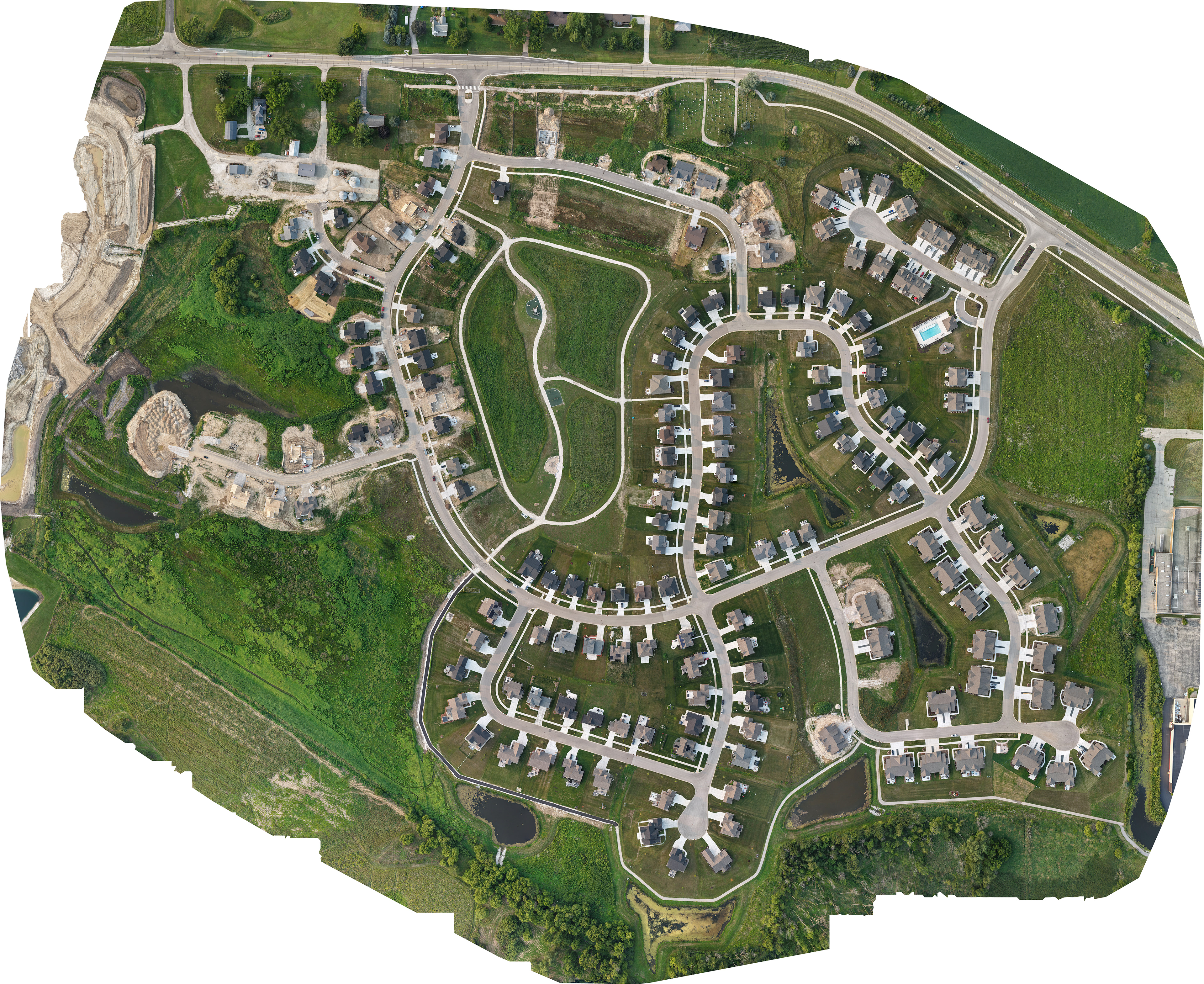
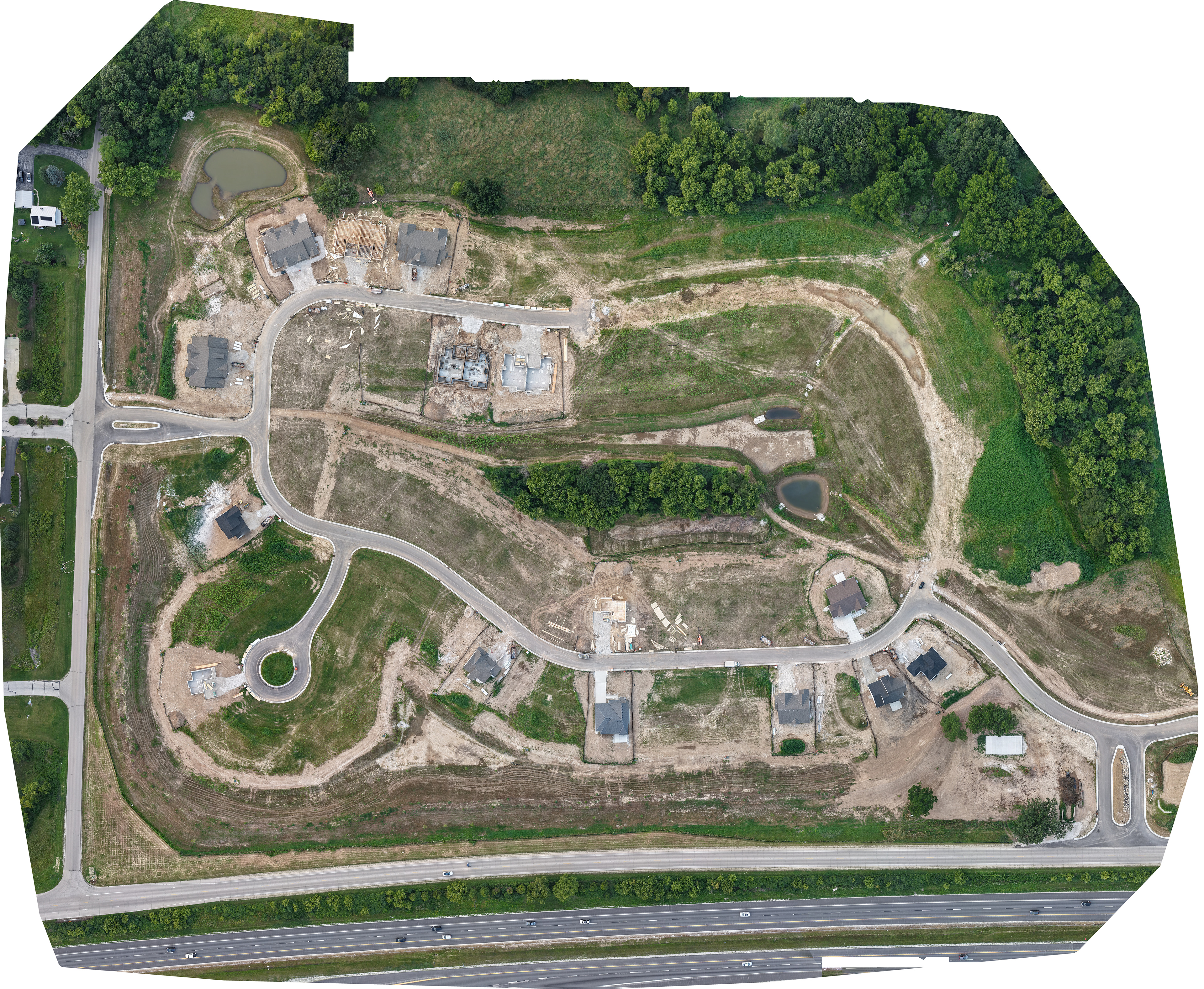
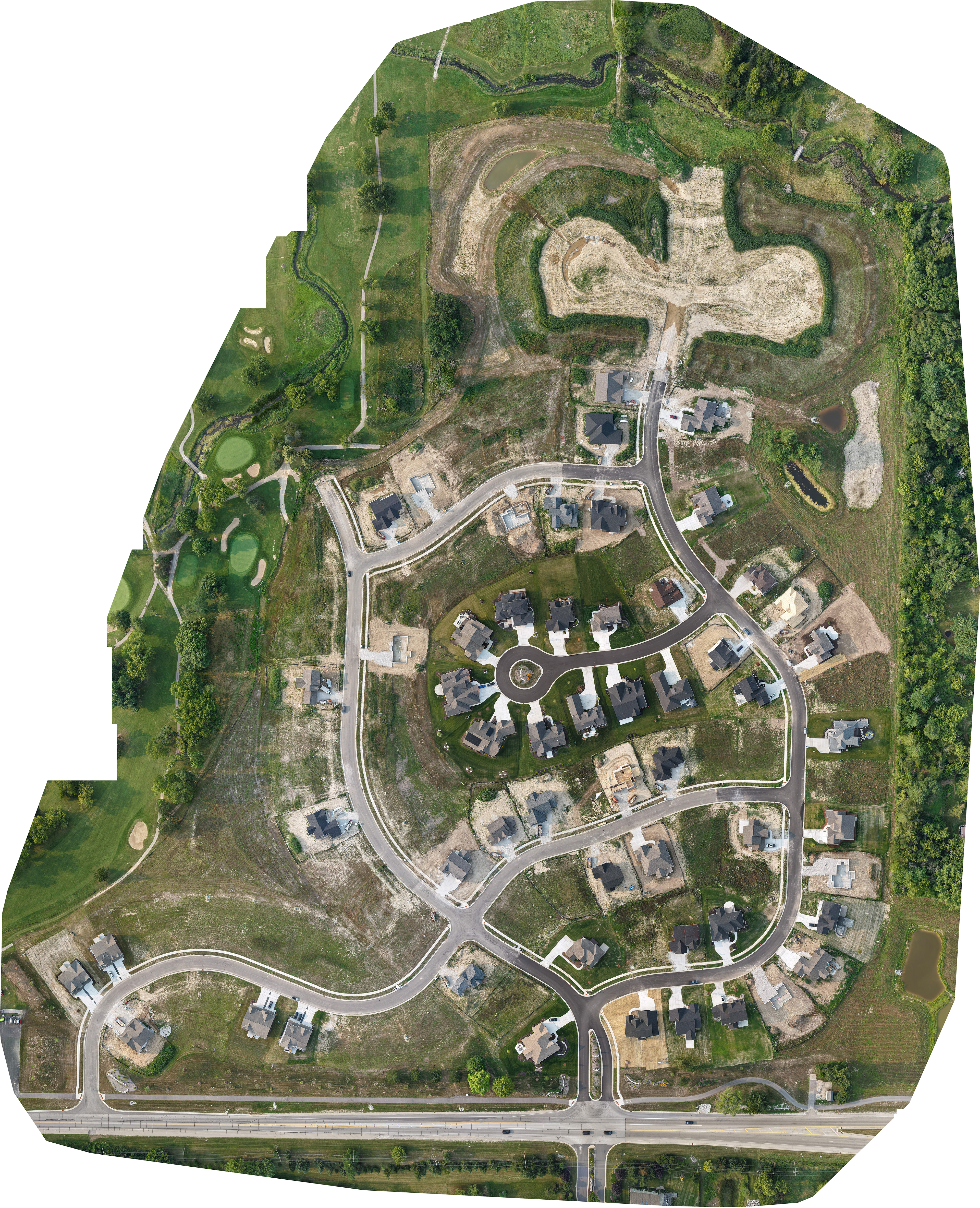


Unlock the power of precision with drone mapping—our advanced photogrammetry solutions turn 100's of high-resolution aerial images into accurate 2D maps, giving you the insights you need to plan smarter and work more efficiently. Whether you're in construction, agriculture, or land surveying, our drone mapping service helps you save time, reduce costs, and make better decisions from the sky down. Please note that we are not a licensed surveyor. We only provide the data.